At ReportAll, our goal is to provide users with the most comprehensive, up-to-date parcel data solutions on the market, while also finding ways to improve the customer experience. With our recently updated API and Feature Service dashboard, users can easily track parcel and tile transactions, during their 30-day free trial and beyond.
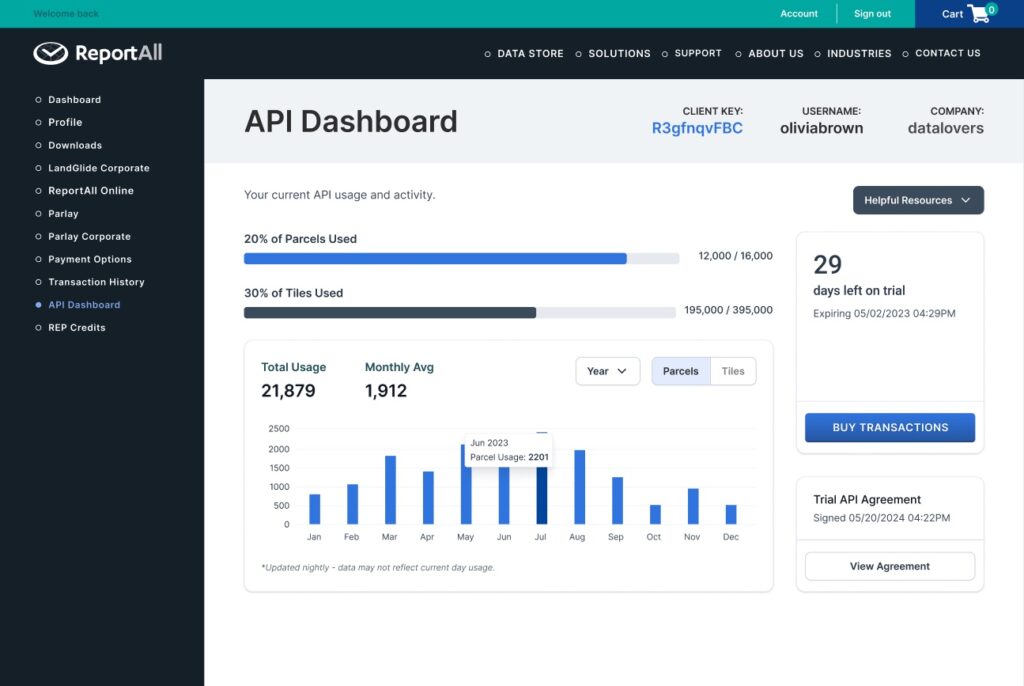
Once logged in, users instantly see usage and activity with the real time percentage breakdown of how many parcels and tiles have been used in relation to the total. Below that, quickly toggle between parcel and tile usage in the bar graph while changing the date range between weekly, monthly, yearly or a customized timeframe. Together, these fields add multiple layers of visibility to one’s transaction usage and balance.
Integration resources for your mapping application
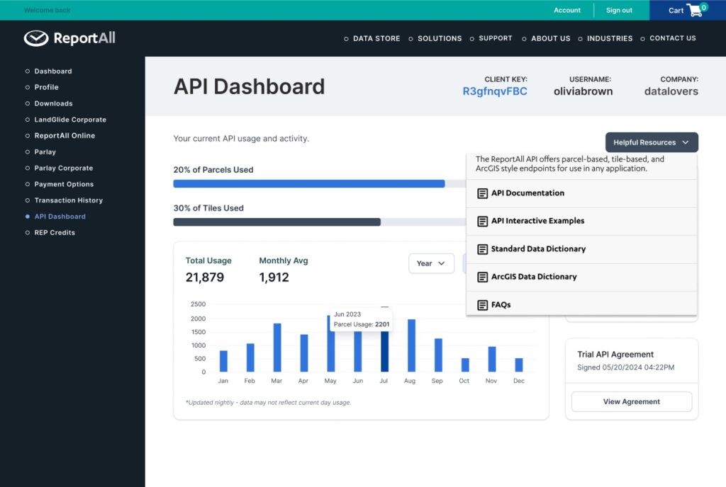
Our parcel-based, tile-based and ArcGIS-style endpoints allow use in any application for API and Feature Service customers. With the newly updated “Helpful Resources” tab, see additional information for:
- Standard Data Dictionary
- ArcGIS® Data Dictionary
- FAQs
- API Examples
These resources were built with the user experience in mind so that customers can confidently integrate our data into their application.
Updated API and Feature Service attributes
Along with a revamped dashboard, we’ve updated and standardized our attribute lists across all sources for API and Feature Service users, including county link, which takes users directly to the county data for a given parcel. By adding these new attributes and updating others, customers can expect quick and easy access to dozens of parcel data points they need.
Updated API attributes
- County Link
- Census_block
- Census_tract
- Fld_zone
- Zone_subty
- Addr_zipplusfour
- Year_Built
- Address
- Census_place
- School_district
- Zoning
- Cty_row_id
- Addr_zip
- Addr_city
Updated ArcGIS/Feature Service attributes
- County Link
- Section_township_range
- Land_cover
- Crop_cover
Our consistently maintained database of 158+ million parcels covering over 99% of the U.S. gives customers fast, reliable access to parcel polygons and data attributes for use in any mapping application in any industry. Now, with our updated API and Feature Service dashboard and attribute lists, customers can buy, track and use our data with ease, decreasing time collecting data from multiple sources — and empowering more informed investment decisions for individual, team or enterprise needs.
Learn more about our API solution and Feature Service. Start your free trial today.