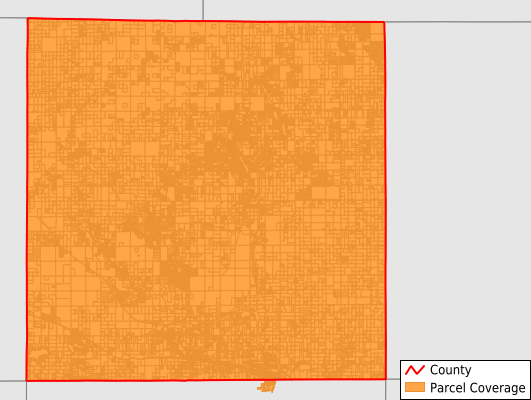
Clare County
Parcel Data
Price: $250.00
Last Updated:
2024-Q3
Parcels in County:
36,545
Parcel data available to download as a GDB, GeoPackage, Shapefile, Excel, CSV, or Google Earth KML file.
All purchased data comes with six months of access, including any updates, at no additional cost.
Key attribute coverage for Clare County
The percentage of Clare County parcels containing the following key attributes:
Owner: 97%
Parcel Number: 97%
Acreage (Calculated): 100%
Site Address: 63.9%
Mailing Address: 95.4%
All available attributes in Clare County
Parcel Number
Site Address
Owner
Transfer Date
Sale Price
Land Use Code
Land Use Class
Zoning
Acreage (deeded)
Acreage (calculated)
Perimeter
Municipality
School District
Zip Code
Flood Zone
Flood Zone Subtype
Census Tract
Census Block Group
Census Block
Land Market Value
Mail Address1
Mail Address3
Legal Desc1
Addr Sec Unit Num
Place Gnis Code
Land Cover
Elevation
Owner Occupied
Robust Id
Usps Residential
Plss Description
Plss Township
Plss Range
Plss Section
Crop Cover
Acreage Adjacent With Sameowner
Municipalities Respresented in Clare County
Arthur Township: 606
Clare City: 1,559
Franklin Township: 1,527
Freeman Township: 2,530
Frost Township: 2,020
Garfield Township: 3,126
Grant Township: 2,453
Greenwood Township: 1,281
Hamilton Township: 2,616
Harrison City: 1,494
Hatton Township: 832
Hayes Township: 5,895
Lincoln Township: 4,000
Redding Township: 935
Sheridan Township: 913
Summerfield Township: 910
Surrey Township: 3,032
Winterfield Township: 816
Save money when you buy data in bulk
We offer discounted pricing on county and state downloads.