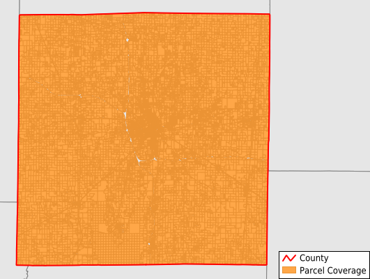
Jefferson County
Parcel Data
Price: $300.00
Last Updated:
2025-Q3
Parcels in County:
30,841
Parcel data available to download as a GDB, GeoPackage, Shapefile, Excel, CSV, or Google Earth KML file.
All purchased data comes with six months of access, including any updates, at no additional cost.
Key attribute coverage for Jefferson County
The percentage of Jefferson County parcels containing the following key attributes:
Owner: 96.7%
Parcel Number: 100%
Acreage (Calculated): 100%
Site Address: 61.8%
Mailing Address: 95.7%
All available attributes in Jefferson County
Parcel Number
Site Address
Owner
Land Use Code
Land Use Class
Acreage (calculated)
Perimeter
Municipality
School District
Zip Code
Flood Zone
Flood Zone Subtype
Census Tract
Census Block Group
Census Block
Coowner
Mail Address1
Mail Address2
Mail Address3
Legal Desc1
Buildings
Docnumber
Addr Sec Unit Num
Place Gnis Code
Land Cover
Elevation
Owner Occupied
Robust Id
Usps Residential
Plss Description
Plss Township
Plss Range
Plss Section
Crop Cover
Acreage Adjacent With Sameowner
Flood Zones
Nearest Transmission Line Dist Ft
Nearest Substation Dist Ft
Derived Geom Properties
Municipalities Respresented in Jefferson County
Bald Hill Township: 1,078
Blissville Township: 623
Casner Township: 1,251
Dodds Township: 2,022
Elk Prairie Township: 1,489
Farrington Township: 768
Field Township: 1,254
Grand Prairie Township: 974
Mcclellan Township: 1,303
Moores Prairie Township: 571
Mount Vernon Township: 8,871
Pendleton Township: 1,191
Rome Township: 2,101
Shiloh Township: 3,704
Spring Garden Township: 1,632
Webber Township: 2,009
Save money when you buy data in bulk
We offer discounted pricing on county and state downloads.