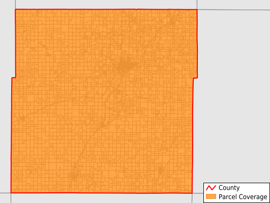
Anderson County
Parcel Data
Price: $200.00
Last Updated:
2026-Q2
Parcels in County:
7,477
Parcel data available to download as a GDB, GeoPackage, Shapefile, Excel, CSV, or Google Earth KML file.
All purchased data comes with six months of access, including any updates, at no additional cost.
Key attribute coverage for Anderson County
The percentage of Anderson County parcels containing the following key attributes:
Owner: 99.4%
Parcel Number: 100%
Acreage (Calculated): 100%
Site Address: 99.4%
Mailing Address: 99.4%
All available attributes in Anderson County
Parcel Number
Site Address
Owner
Neighborhood Code
Land Use Code
Land Use Class
Acreage (calculated)
Perimeter
Municipality
School District
Zip Code
Flood Zone
Flood Zone Subtype
Census Tract
Census Block Group
Census Block
Mail Address1
Legal Desc1
Addr Sec Unit Num
Place Gnis Code
Land Cover
Elevation
Owner Occupied
Robust Id
Usps Residential
Alt Id 1
Plss Description
Plss Township
Plss Range
Plss Section
Crop Cover
Acreage Adjacent With Sameowner
Flood Zones
Nearest Transmission Line Dist Ft
Nearest Substation Dist Ft
Derived Geom Properties
Robust Id Source
Municipalities Respresented in Anderson County
Reeder Township: 512
Putnam Township: 323
Walker Township: 682
Westphalia Township: 464
Monroe Township: 386
Washington Township: 345
Jackson Township: 401
Lincoln Township: 366
Welda Township: 386
Indian Creek Township: 252
Ozark Township: 563
Lone Elm Township: 341
Rich Township: 590
Garnett City: 1,866
Save money when you buy data in bulk
We offer discounted pricing on county and state downloads.