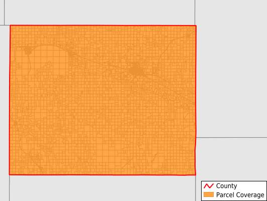
Mitchell County
Parcel Data
Price: $200.00
Last Updated:
2026-Q2
Parcels in County:
7,510
Parcel data available to download as a GDB, GeoPackage, Shapefile, Excel, CSV, or Google Earth KML file.
All purchased data comes with six months of access, including any updates, at no additional cost.
Key attribute coverage for Mitchell County
The percentage of Mitchell County parcels containing the following key attributes:
Owner: 99.9%
Parcel Number: 100%
Acreage (Calculated): 100%
Site Address: 99.9%
Mailing Address: 99.9%
All available attributes in Mitchell County
Parcel Number
Site Address
Owner
Neighborhood Code
Land Use Code
Land Use Class
Acreage (calculated)
Perimeter
Municipality
School District
Zip Code
Flood Zone
Flood Zone Subtype
Census Tract
Census Block Group
Census Block
Mail Address1
Legal Desc1
Addr Sec Unit Num
Place Gnis Code
Land Cover
Elevation
Owner Occupied
Robust Id
Usps Residential
Alt Id 1
Plss Description
Plss Township
Plss Range
Plss Section
Crop Cover
Acreage Adjacent With Sameowner
Flood Zones
Nearest Transmission Line Dist Ft
Nearest Substation Dist Ft
Derived Geom Properties
Robust Id Source
Municipalities Respresented in Mitchell County
Cawker Township: 638
Glen Elder Township: 591
Solomon Rapids Township: 211
Plum Creek Township: 247
Lulu Township: 265
Walnut Creek Township: 203
Carr Creek Township: 153
Pittsburg Township: 386
Hayes Township: 194
Center Township: 171
Turkey Creek Township: 232
Bloomfield Township: 220
Beloit Township: 382
Logan Township: 290
Asherville Township: 261
Custer Township: 346
Blue Hill Township: 169
Round Springs Township: 122
Salt Creek Township: 149
Eureka Township: 154
Beloit City: 2,126
Save money when you buy data in bulk
We offer discounted pricing on county and state downloads.