
Have you ever wondered how Santa is able to make it to every house in one night? It’s not without careful planning or trusted partners, like ReportAll USA, Mother Nature and maybe a touch of magic.
Santa’s Data Scientists (also known as his “elves”) prepare all year planning Santa’s route with care, using the most up to date ReportAll parcel data. With the help from the ReportAll Online 24/7 web application, Santa’s elves strategize and map out how Santa will visit all U.S. residential parcels on Christmas Day using ReportAll’s parcel data from all 50 states. Beyond just the route, with the use of shapefiles Santa’s elves explore specific data attributes for each parcel, giving Santa all the information he needs and more to have a successful Christmas delivery.
Using Parcel Data to Plan Santa’s Route
It may seem like Santa Claus could use the same route to deliver joy and toys year after year, but many things can change in 365 days on a route as colossal as his. New parcels can be added, owner names or land use codes could change, or someone may just move from the nice to the naughty list. Santa’s elves have to prepare for all of these changes and more.
With ReportAllUSA.com, Santa’s elves can easily purchase and download shapefiles to carefully map out Mr. Claus’ extensive route across the nation. With this data in hand, Santa and his elves can determine the correct addresses for everyone on the “nice” list, as well as the distance to cover, and exact landing for his stops to residential parcels: all important info to have in hand when you have around 150 million parcels to visit in one night.
- Commercial vs. Residential: By combining parcel data with USPS address attributes, the elves can use filters to make sure they send Santa only to residential parcels, where he can be sure to find stockings hung by the chimney with care.
- Determine Spatial Routing: Through geospatial analysis and routing, the elves calculate how much time it will take for Santa and his sleigh to travel from one parcel to the next, skipping over non-residential properties, while also taking the reindeer flying speed and distance into consideration. It’s also important for them to buffer in time for Dasher’s snack breaks.
- Key Parcel Data Considerations for Santa: While the elves work hard to plan the official route, they also include other important notes based on ReportAll’s parcel data layer, such as giving Santa a heads-up for flood zones, increases in elevation, and when he’s entering a new municipality or state. Colder states require extra hot cocoa in hand.
Santa Uses the LandGlide® Mobile App for Updates On The Go
Even with all the careful planning, Santa will still need to make some quick adjustments while out in the field on the big night. This is where the LandGlide® Mobile App comes in.
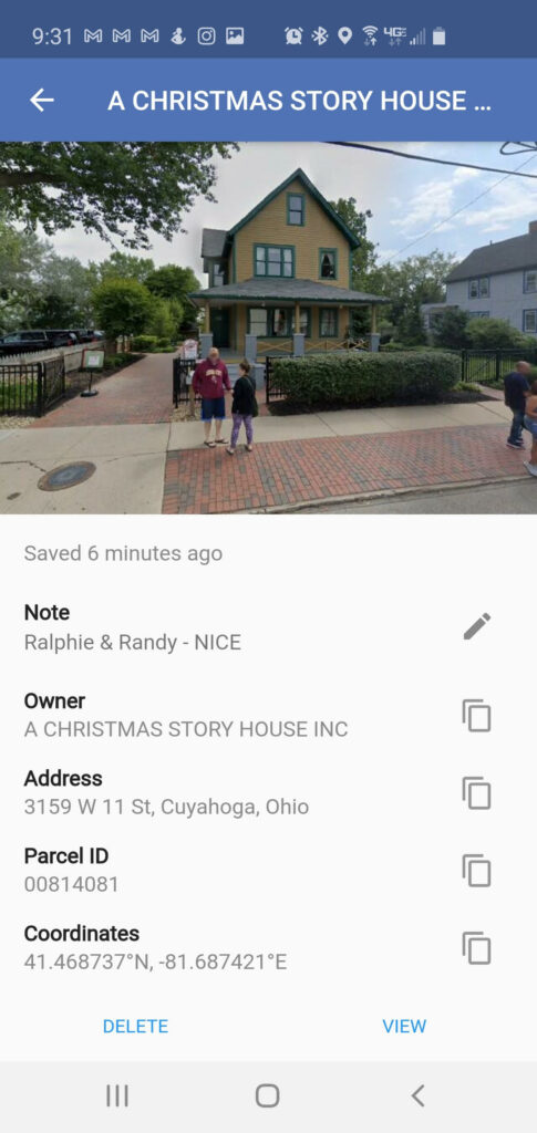
Once Santa leaves the North Pole, LandGlide® equips him with everything he needs to know in the palm of his leather glove. From aerial views to check for chimney placement, to street views available at the drop of a pin, Santa can ensure he’s at the right residence based on the data from his elves and plan ahead for his next delivery stop while en route.
Utilizing saved locations within the LandGlide® mobile app, allows Santa to track real-time data to bring back to his elves for next Christmas. He can save locations and add notes to track the best cookies, who has skinny chimneys, and where he can count on the best snacks to fuel his reindeer, while also keeping his Naughty and Nice lists updated!
ReportAll Geographic Expansions – What’s New in 2020
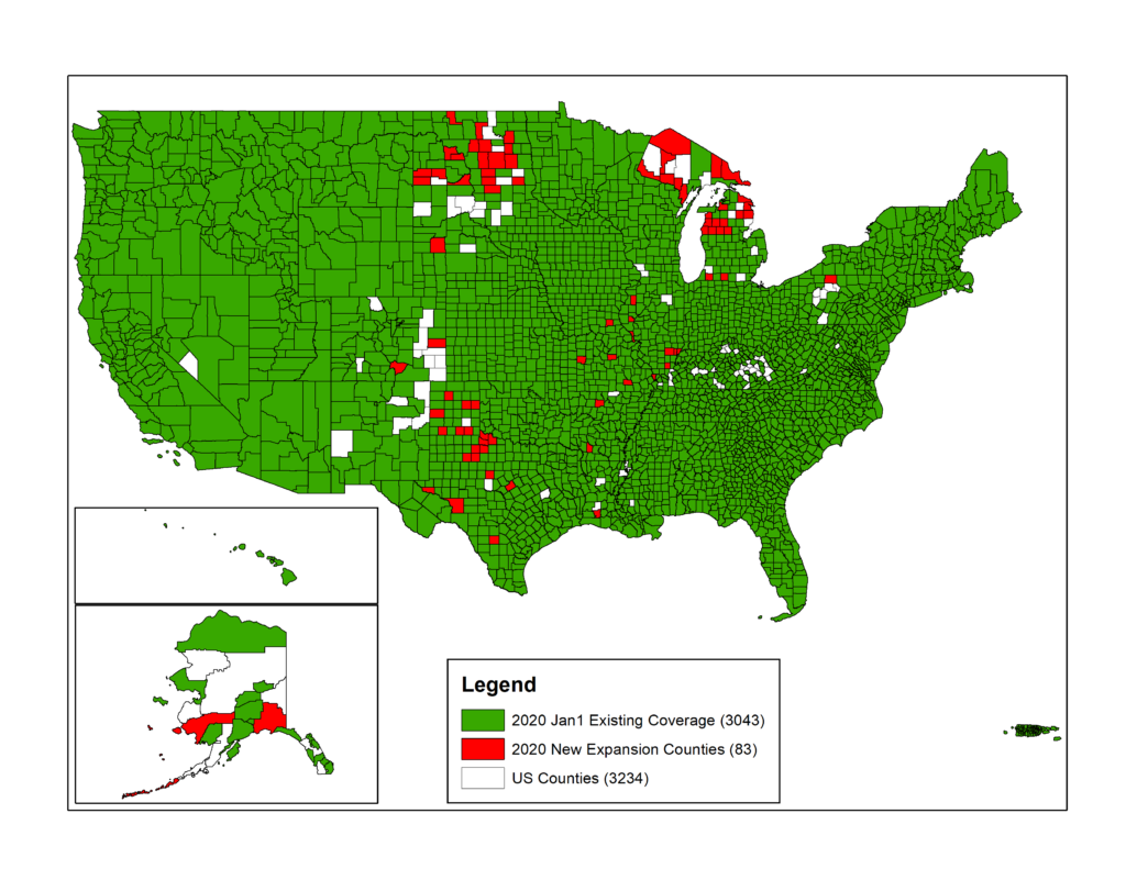
Santa’s elves always have access to the largest, most up-to-date parcel polygon data layer when mapping Santa’s route. And this year was no exception – Santa had the latest updates for his route thanks to ReportAll’s geographic expansions in 2020, which included:
- 83 additional counties and counting
- Significant parcel layer additions in Texas, Michigan, North Dakota, South Dakota and Illinois
- The addition of ~85 million building footprints
- And the current coverage for ReportAll’s parcel data layer:
- Over 3,127 counties
- Over 154M parcels
With a little bit of magic and parcel data, Santa’s operation stays efficient and successful each year. While Santa and his elves work to finalize the details for his holiday delivery route — ReportAll is spreading a little early holiday cheer with a 7-day free trial for new LandGlide customers – try it now on iOS or Android.
Or try a free 14-day trial of PARLAY 2.0, a parcel data layer for Google Earth, or see how a parcel data API can enhance your application with a 30-day limited API free trial.
From our ReportAll family to yours, we wish you a very Happy Holiday and Healthy New Year!