Why Do ReportAll Customers Rely On Our Parcel Data API
Our API provides your application with fast and reliable access to parcel polygons and data attributes — all while incurring costs only when your customers access data. With next-generation technology, our parcel data API delivers to customers current property details and parcel polygons for use in any mapping application in any industry.
What do the insurance and the agricultural industry have in common?
Learn how two valued ReportAll customers; Tillable — a farmland marketplace and Maprisk — an insurance risk assessment tool, utilize the ReportAll API to create custom, industry-specific solutions for their clients.
Tillable provides information about agricultural property for lease or sale across the United States. They currently have over 1,000,000 claimed acres and are rapidly growing.
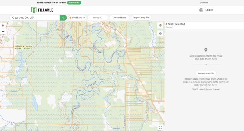
Tillable – Farmland Parcel Data
The Tillable application offers a wide range of solutions including a map viewer that connects farmers and landowners nationwide to farmland parcels to lease, buy or sell. When Tillable sought to expand their application on a national scale, the ReportAll API provided the solution that they needed.
With the help of ReportAll’s API, Tillable users are able to:
- Browse property line maps and access parcel data with a few clicks.
- Quickly locate details about farm properties, including owner names, APN number, acreage and more.
- Search for and view groups of farmland parcels that are owned by the same person.
- Overlay parcel boundaries on a map and construct the outer boundary of a farm from an assemblage of parcels, then add this land definition to their Tillable account.
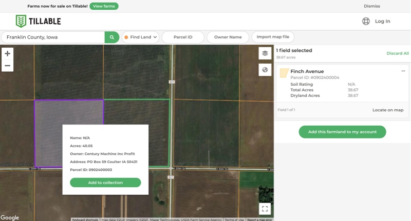
NEW from Tillable: Tillable’s latest feature allows users to view and access recently listed farms for sale. By using the ReportAll API connection, users can draw around the farm area they would like to assess with ease and access property details across multiple parcels.
Learn more about Tillable.
Maprisk – Parcel Data Driven Underwriting
Maprisk provides parcel data to underwriters in the insurance industry. By combining the geospatial accuracy of parcel data with other available data layers, Maprisk provides actionable information to support insurance underwriters for the full life cycle of a policy from quote to claim.
By providing geospatial mapping capabilities, Maprisk gives their customers the ability to lookup a property address to efficiently and effectively assess risk using various available data layers, ultimately allowing them to create coverage plans at the time of underwriting.
Accurate and comprehensive parcel data is a key delineator when quoting insurance policies. With the help of ReportAll’s API, Maprisk users are able to:
- Overlay hazard risk layers (i.e. flood zone, wildfire, etc.) over parcel data to calculate a property’s total risk.
- Apply building footprints to hazard risk layers to create a more definitive layer of analysis.
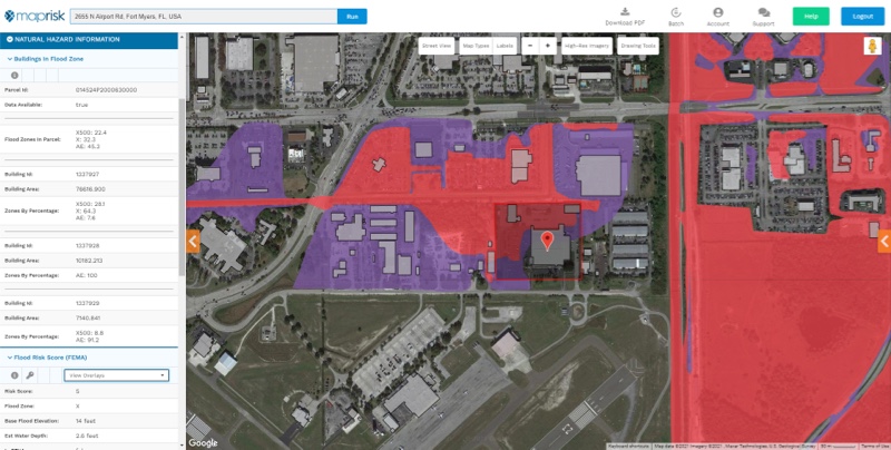
Maprisk Application Feature: Maprisk’s handy URL quote generator and saved query feature make accessing policy data easier and more efficient.
Learn more about Maprisk.
Get More With ReportAll’s API

The ReportAll API provides access to current land ownership maps and other property details in over 3,100 counties. Our API is compatible with various mapping technologies, making it adaptable to any application in a wide range of industries.
Why Choose ReportAll’s API?
- Access to Nationwide Data in Real Time: offers nationwide coverage at a pay-as-you-go model, allowing you to ramp up as your customer footprint grows.
- Pay only for data that your application consumes.
- 95% Coverage Across the U.S.
- Data is maintained and updated regularly by ReportAll, leading to current and accurate data.
- Remote-hosted solution: with API access there is no need to host/maintain data in your environment, resulting in cost savings from tools and data processing.
- Easy integration with various mapping technologies.
- API documentation provided on the website.
- Our parcel data API and team of experts are available to help provide your application with real time and seamless integration.
Interested in trying the ReportAll parcel data API? Get a FREE 30 Day Trial! When you sign up for our free trial you will receive 1,000 free parcel transactions and 20,000 free tile transactions to use for evaluation within the 30-day window. Sign up now or contact us for more information.