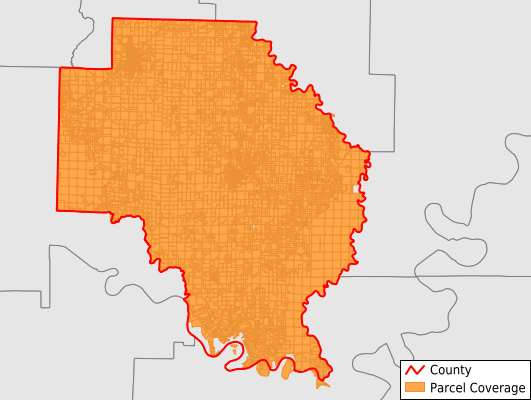
Arkansas County
Parcel Data
Last Updated:
2026-Q1
Parcels in County:
16,044
Parcel data available to download as a GDB, GeoPackage, Shapefile, Excel, CSV, or Google Earth KML file.
All purchased data comes with six months of access, including any updates, at no additional cost.
Key attribute coverage for Arkansas County
The percentage of Arkansas County parcels containing the following key attributes:
Owner: 100%
Parcel Number: 100%
Acreage (Calculated): 100%
Site Address: 68.3%
Mailing Address: 99.5%
All available attributes in Arkansas County
Parcel Number
Site Address
Owner
Building Size
Land Use Code
Land Use Class
Acreage (calculated)
Perimeter
Municipality
School District
Zip Code
Flood Zone
Flood Zone Subtype
Census Tract
Census Block Group
Census Block
Total Market Value
Land Market Value
Building Market Value
Mail Name
Mail Address1
Mail Address3
Legal Desc1
Year Built
Total Bath
Addr Sec Unit Num
Place Gnis Code
Land Cover
Elevation
Owner Occupied
Robust Id
Usps Residential
Plss Description
Plss Township
Plss Range
Plss Section
Crop Cover
Acreage Adjacent With Sameowner
Flood Zones
Nearest Transmission Line Dist Ft
Nearest Substation Dist Ft
Derived Geom Properties
Robust Id Source
Municipalities Respresented in Arkansas County
Arkansas Township: 343
Bayou Meto Township: 337
Brewer Township: 311
Chester Township: 778
Crockett Township: 377
Garland Township: 212
Gum Pond Township: 4,995
Henton Township: 578
Keaton Township: 1,168
La Grue Township: 3,200
Mcfall Township: 166
Mill Bayou Township: 488
Morris Township: 469
Point Deluce Township: 438
Prairie Township: 1,203
Stanley Township: 672
Barton Township: 289
Save money when you buy data in bulk
We offer discounted pricing on county and state downloads.