Last Updated:
2026-Q1
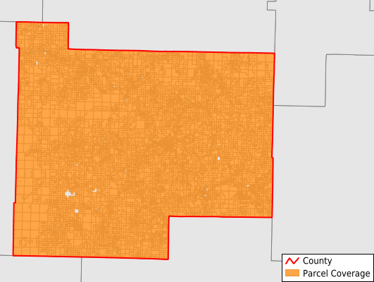
Parcels in County:
11,853
Parcel data available to download as a GDB, GeoPackage, Shapefile, Excel, CSV, or Google Earth KML file.
All purchased data comes with six months of access, including any updates, at no additional cost.
Key attribute coverage for Searcy County
The percentage of Searcy County parcels containing the following key attributes:
Owner: 100%
Parcel Number: 100%
Acreage (Calculated): 100%
Site Address: 68.5%
Mailing Address: 97.4%
All available attributes in Searcy County
Parcel Number
Site Address
Owner
Building Size
Neighborhood Code
Land Use Code
Land Use Class
Acreage (calculated)
Perimeter
Municipality
School District
Zip Code
Census Tract
Census Block Group
Census Block
Total Market Value
Land Market Value
Building Market Value
Mail Address1
Mail Address3
Legal Desc1
Year Built
Bedrooms
Fullbath
Addr Sec Unit Num
Place Gnis Code
Land Cover
Elevation
Owner Occupied
Robust Id
Usps Residential
Plss Description
Plss Township
Plss Range
Plss Section
Crop Cover
Acreage Adjacent With Sameowner
Nearest Transmission Line Dist Ft
Nearest Substation Dist Ft
Derived Geom Properties
Robust Id Source
Municipalities Respresented in Searcy County
Calf Creek Township: 847
Long Creek Township: 691
Mount Pleasant Township: 1,143
Prairie Township: 707
Red River Township: 567
Rock Creek Township: 791
St. Joe Township: 513
Shady Grove Township: 374
Spring Township: 863
Tomahawk Township: 1,079
Wileys Cove Township: 1,121
Bear Creek No. 4 Township: 1,057
Bear Creek No. 5 Township: 495
Bear Creek No. 6 Township: 900
Oxley Township: 705
Save money when you buy data in bulk
We offer discounted pricing on county and state downloads.