Last Updated:
2026-Q2
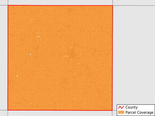
Parcels in County:
17,393
Parcel data available to download as a GDB, GeoPackage, Shapefile, Excel, CSV, or Google Earth KML file.
All purchased data comes with six months of access, including any updates, at no additional cost.
Key attribute coverage for Franklin County
The percentage of Franklin County parcels containing the following key attributes:
Owner: 99.9%
Parcel Number: 100%
Acreage (Calculated): 100%
Site Address: 38.4%
Mailing Address: 97.4%
All available attributes in Franklin County
Parcel Number
Site Address
Owner
Land Use Code
Acreage (calculated)
Perimeter
Municipality
School District
Zip Code
Flood Zone
Flood Zone Subtype
Census Tract
Census Block Group
Census Block
Mail Name
Mail Address1
Mail Address3
Legal Desc1
Legal Desc2
Addr Sec Unit Num
Place Gnis Code
Land Cover
Elevation
Owner Occupied
Robust Id
Usps Residential
Plss Description
Plss Township
Plss Range
Plss Section
Crop Cover
Acreage Adjacent With Sameowner
Flood Zones
Nearest Transmission Line Dist Ft
Nearest Substation Dist Ft
Derived Geom Properties
Robust Id Source
Municipalities Respresented in Franklin County
Geneva Township: 921
Grant Township: 853
Hamilton Township: 722
Hampton City: 2,334
Ingham Township: 902
Lee Township: 774
Marion Township: 1,392
Morgan Township: 920
Mott Township: 911
Oakland Township: 899
Osceola Township: 965
Reeve Township: 910
Richland Township: 752
Ross Township: 785
Scott Township: 974
Sheffield City: 875
West Fork Township: 742
Wisner Township: 762
Save money when you buy data in bulk
We offer discounted pricing on county and state downloads.